John's Pacific Crest Trail Hiking
2011 - 2014 Hikes On Map:
- September 2014 - Southern Sierra: Whitney Portal to Walker
Pass
- September 2013 - Northern Washington: Stevens Pass to Canada
- August 2013 - Donner to Shasta
- May 2013 - Mexican border to Agua Dulce
- 2012 - Southern Washington to Stevens Pass
- 2011 - Northern CA and Southern Oregon: Shasta to Crater
Lake
I plan to add earlier hikes to the map:
- October 2010 - Southern Oregon: Crater Lake - Willamette
Pass
- September 2010 - Yosemite to Donner Pass
- 2009 - Northern Oregon: Willamette Pass - Cascade
Locks
- ~1998 - Sierras, John Muir Trail - Yosemite to Mt. Whitney
Remaining
section:
- ~April 2015 - Agua Dulce to Walker Pass - Mojave Desert
(200 miles)
PCT and Lightweight
Backpacking Resources
Google Earth
Highly recommended - can download at - http://www.google.com/earth/download/ge/
. Google Earth app also works.
Google Earth may start automatically, or you may have to save file and
open with Google Earth.
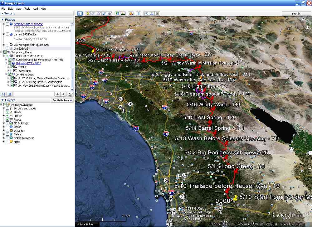
Hike will be in
"Temporary Places".
Open "JH PCT Hikes 2011-2014" to show hikes and
more information:
Double-click in "JH
Hiking Days" to select hikes:
- JH 2011 Hiking Days - Shasta to Crater Lake
- JH 2012 Hiking Days - S Washington
- JH 2013 Hiking Days - May - Mexico to Agua Dulce
- JH 2013 Hiking Days - August - Donner to Shasta
- JH 2013 Hiking Days - Sept - N Washington - Canada
- JH 2014 Hiking Days - Sept - Whitney - Walker Pass
Check boxes to give give
more information:
Add 1/2 mile markers.
Add waypoints.
See check boxes at bottom left.
Photos are on.
Check other boxes for more information.
Other overlays can be downloaded. E.g. USGS topo maps.
I use Quads .
Google for more topos and other
overlays.
Classic Google
Maps
***Google may change
this, e.g. in Feb. 2015. Please email me if you have problems.

Open
Classic Google
Maps using this link and copy the
following into the
Search Box: http://swunderstanding.com/hikes/jh-pct-hikes.kmz
Check/uncheck, open/close,
double-click menu selections at the left to see different hikes and
information.
Close Halfmile folders and scroll to bottom to see JH Hikes.
Click markers to see their descriptions.
Click "Satellite",
"Photos"
, "Terrain"
(with contours) and other selections at top right.